Rally Points
Rally Points overview
When commanding a Smart Rally Point (SRP), the UA will fly towards the rally point with the closest path towards it.
This is particularly useful when flying in dense airspaces or areas with limited ground control in a way that, in the event of a degradation of the flight conditions, the UA could fly towards a rally point and land in safer conditions.
It is also useful in operations where battery degradation has been observed by the remote crew or detected by the system, in order to land in a safe enough place.
Operators shall ensure that rally points are not only within the operational volume (geocage and pregeocage), but also that the paths towards the rally points are within this volume.
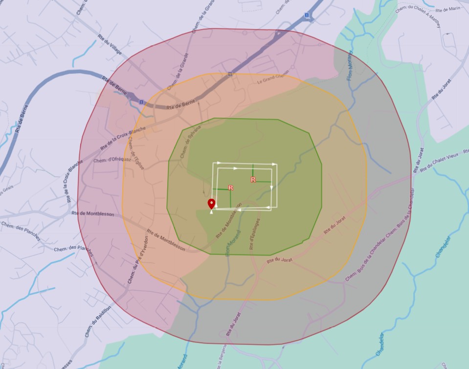
Rally points menu: allows to see the rally point list and their information, center the map on any of them or remove them.
List of rally points:
- Rally point identification
- Expand/collapse rally point information
- Center the map on the rally point
- Remove the rally point
- Rally point information (coordinates and altitude)
Operators should decide if the takeoff and/or landing waypoints should be considered rally points or not.
In the map, white lines connecting the flight path to the closest rally point (including takeoff and landing points, if so enabled) are displayed. Turning manoeuvres that might be required to go towards the rally point are not displayed.
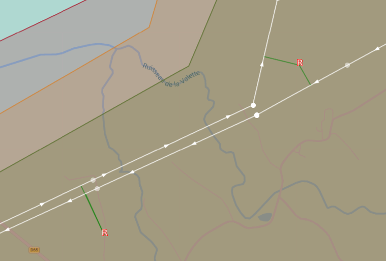
- During an SRP command, the autopilot chooses the "closest" rally point by minimising the along-route distance from the UA projection to the rally point branch-off projection (pluse a penalty of 4 km if a fixed-wing U-turn is required).
- Rally points whose path (branch-off to rally point) breaches the geocage are rejected.
- If there are no rally points available, SRP falls back to the closest operation endpoint (takeoff or landing) based on the same path-cost logic (insted of continuing to the mission-end).
- Coinciding segments: the same rally point can be projected onto several segments allowing to fly A-B-A and/or loop operations with optimal route to the rally point.
Rally Points altitude
More information on Rally Points and the UAS behaviour is given in the UAS Flight Manual.