Operation structure
Within RigiTech UAS Technical Manuals, operational restrictions supporting flight planning can be found in Appendix - Operational Restrictions.
Altitude graph
The altitude graph is a fundamental tool to do a preliminary check of the altitudes and vertical structure of the flight plan, since it provides information on the terrain (without obstacles), waypoints, geocages (see Geocages) and maximum flight altitude deviations.
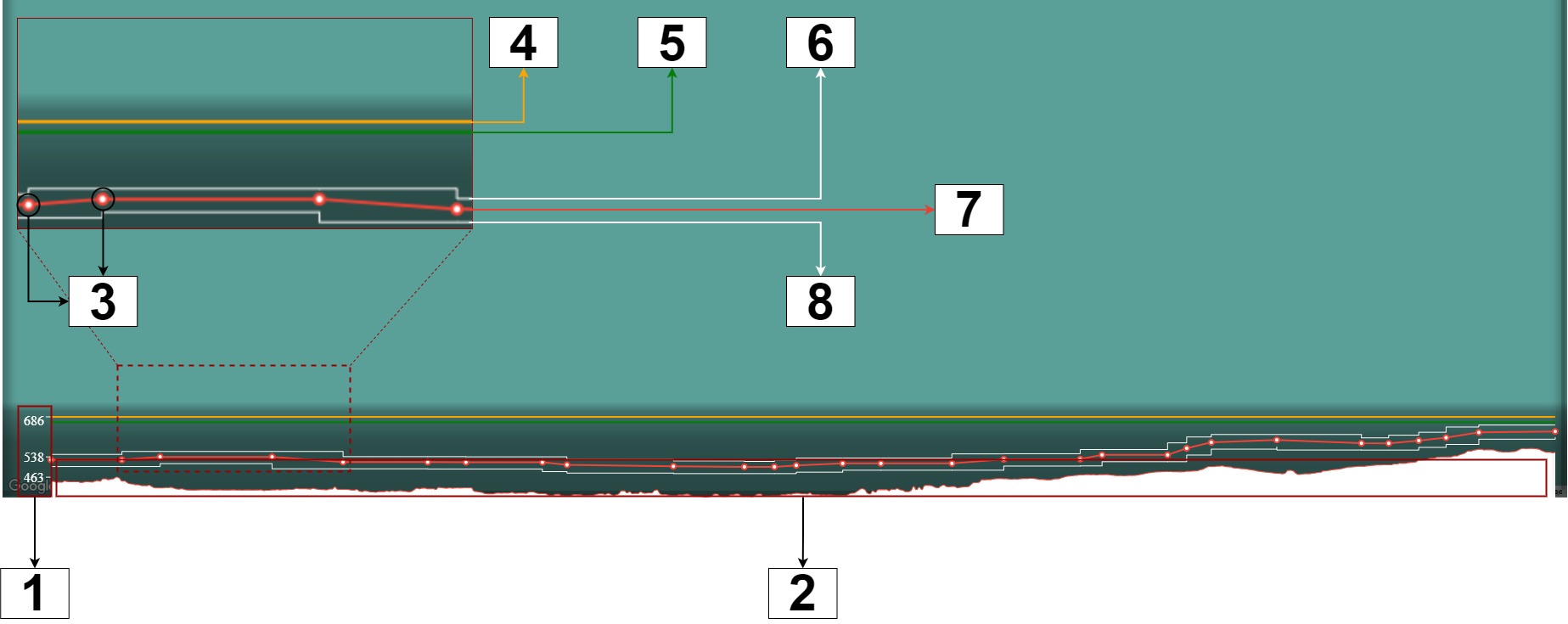
- Altitude scale (in m AMSL)
- Terrain profile
- Waypoints
- Altitude of the geocage (orange by default)
- Altitude of the pregeocage (green by default)
- Upper deviation limit of the flight altitude (white)
- Flight path (red)
- Lower deviation limit of the flight altitude (white)
In order to avoid collisions with the terrain and ensure a proper structure of the vertical containment, as a preliminary step, the altitude graph can be used to ensure that:
- The flight path is above the terrain
- The lower deviation limit of the flight altitude is above the terrain
- The upper deviation limit of the flight altitude is not above the pregeocage
- The pregeocage is below the geocage
Disclaimer:
- The altitude data sources do not include artificial and natural obstacles.
- The operator shall consult with their competent authority what sources are acceptable to ensure proper obstacle avoidance.
- The operator shall evaluate the presence of obstacles in their operational volume and plan operations accordingly.
- RigiTech is not responsible for any decision taken by the operator due to the interpretation of the altitude data.
Zoom
It is possible to zoom in a section of the altitude graph by hovering the mouse over the altitude graph, keep left-click, grab the section and release it.

Onced zoomed in, to go back to the general graph, users should left-click over the altitude graph again.

Others
Specific elements limitations and vertical structures of a UAS shall be consulted in the UAS Flight Manual (vertical structure, transitions, turnsm safety distances, etc.).