Telemetry
Overview
The telemetry provides detailed information of the UAS behaviour, such as speeds, altitudes or weather information. The units are displayed in the box and may vary depending on the project settings.
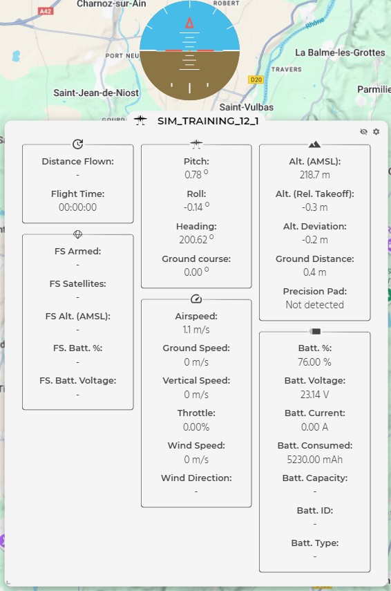
The telemetry box displayed on the map can be shown/hidden and edited (both in content, which depends on the selected setings, and size/position). The box and the indicator can be moved and the size of the box can be selected by the operator (by clicking on the bottom-left corner of the box and dragging it).
If the size of the telemetry box is too small for the amount of information needed, a scrolling bar will appear at the right side of the box, allowing to navigate through it.
Telemetry settings
After opening the telemetry settings, the following menu will be displayed.
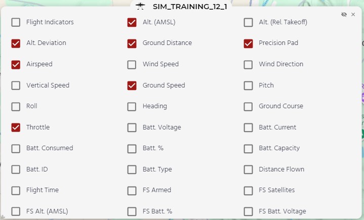
Users can select how much information is displayed. The available settings are:
- Flight indicators: pictogram with the relative horizon (represents pitch and roll).
- Alt. (AMSL): absolute altitude, in AMSL.
- Alt. (Rel Takeoff): relative altitude, in "AGL" (referenced to the takeoff point, not to the ground level).
- Alt. Deviation: difference between the altitude of the UAS and the planned altitude.
- Ground Distance: when available, shows the distance to the ground (measured by the Lidar).
- Precision Pad: shows if the precision pad is detected or not.
- Airspeed: speed of the aircraft relative to the surrounding air.
- Wind Speed: estimated wind speed.
- Wind Direction: estimated wind direction. Also visible in the map (when enabled) as an arrow next to the vehicle (only while flying in fixed-wing).
- Vertical speed: rate of climb or descent.
- Ground Speed: actual speed over the ground, affected by wind.
- Pitch: angle of the nose up or down relative to the horizon.
- Roll: rotation of the aircraft around its front-to-back axis (wing tilt).
- Heading: direction of the aircraft’s nose is pointing, relative to north.
- Ground Course: path followed by the aircraft over the ground, relative to north.
- Throttle: type of the battery.
- Batt. Voltage: main battery/ies voltage.
- Batt. Current: main battery/ies current.
- Batt. Consumed: main battery/ies consumption.
- Batt. %: estimated percent of remaining battery of the main battery/ies.
- Batt. Capacity: capacity of the battery.
- Batt. ID: identification number of the battery.
- Batt. Type: type of the battery.
- Distance Flown: total distance flown by the vehicle.
- Flight Time: total time of the flight. It starts when the vehicle starts its flight.
- FS Armed: shows if the failsafe is "Armed" or "Disarmed".
- FS Satellites: number of satellites detected by the failsafe GNSS.
- FS Alt. (AMSL): altitude measured by the failsafe, in AMSL.
- FS Batt. %: estimated percent of remaining battery in the failsafe battery.
- FS Batt. Voltage: failsafe battery voltage.