Air traffic detection
As defined in the Airbridge planner section, RigiCloud can represent air traffic in the map (as long as there are available means to detect specific traffic). Although this feature might be useful under specific cases while planning an operation, its main use is to provide detection capabilities during operations, which is why its use is presented in this section.
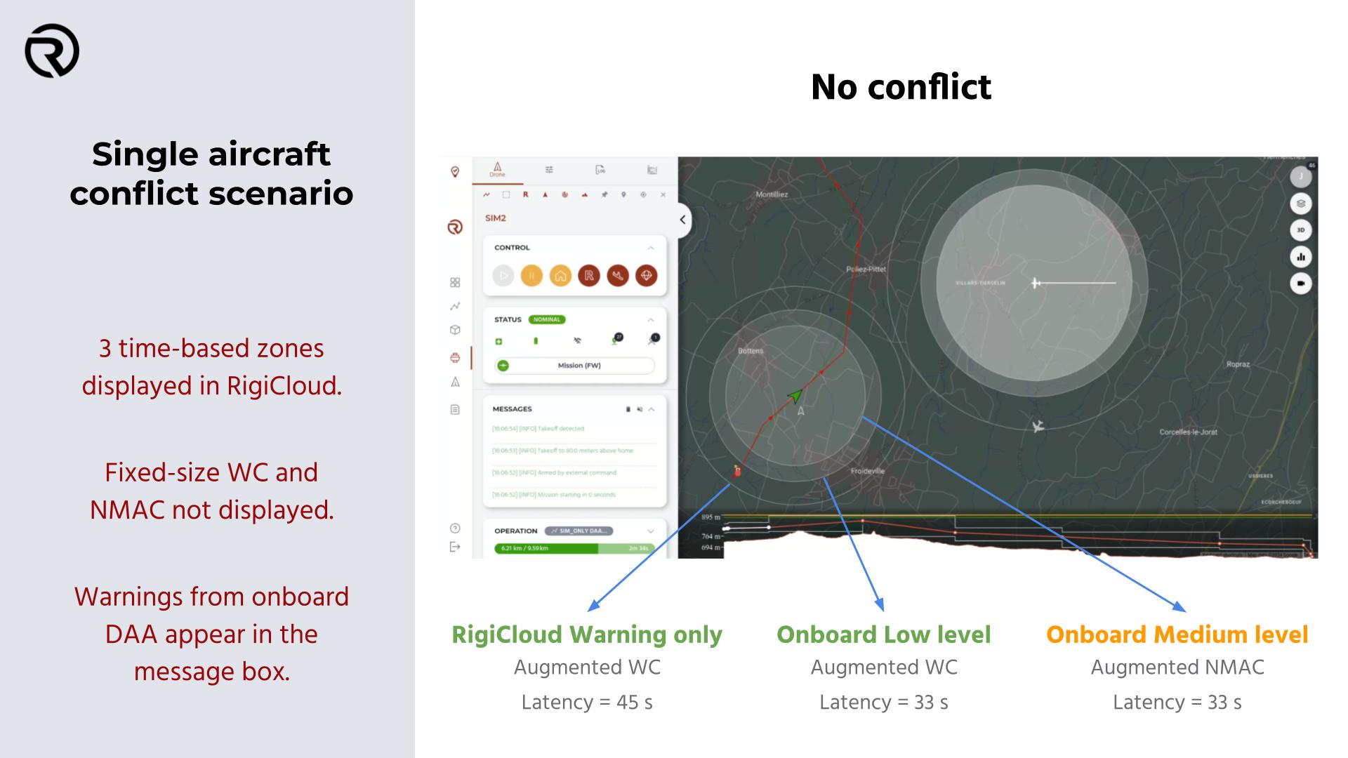
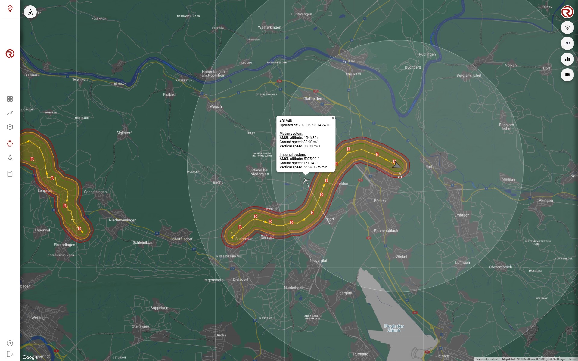
When the "Air traffic" filter is on, as long as there are aircraft detectable within the selected ranges (altitude and detection technology), a certain number of aircraft will be displayed in the map. Depending on certain parameters, their representation will be different:
- Type of aircraft: RigiCloud can separate between large aircraft, light aircraft, helicopters and sky divers.
- Altitude: Independently of the altitude range selected in the filter, aircrafts at low altitude will be displayed more intensely, while aircraft flying at high altitudes will be more and more translucent.
- Heading: The heading of the aircraft is represented on the map with the heading of the icon.
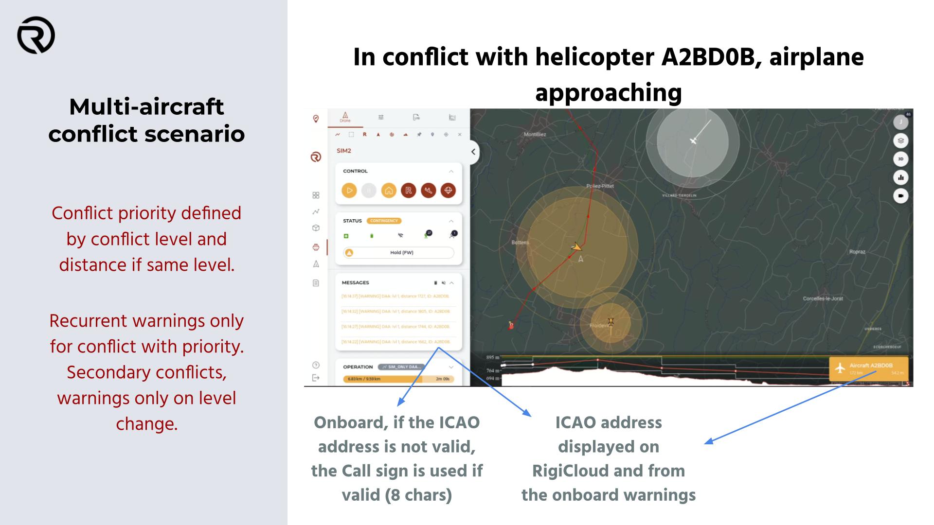
Additionally, when right-clicking on an aircraft, a box will be displayed with additional information. From top to bottom:
- ID of the aircraft
- Time of the last update
- Information in metric and imperial system:
- AMSL Altitude (in m and in ft).
- Ground speed (in m/s and in kts).
- Vertical speed (in m/s and in ft/min).
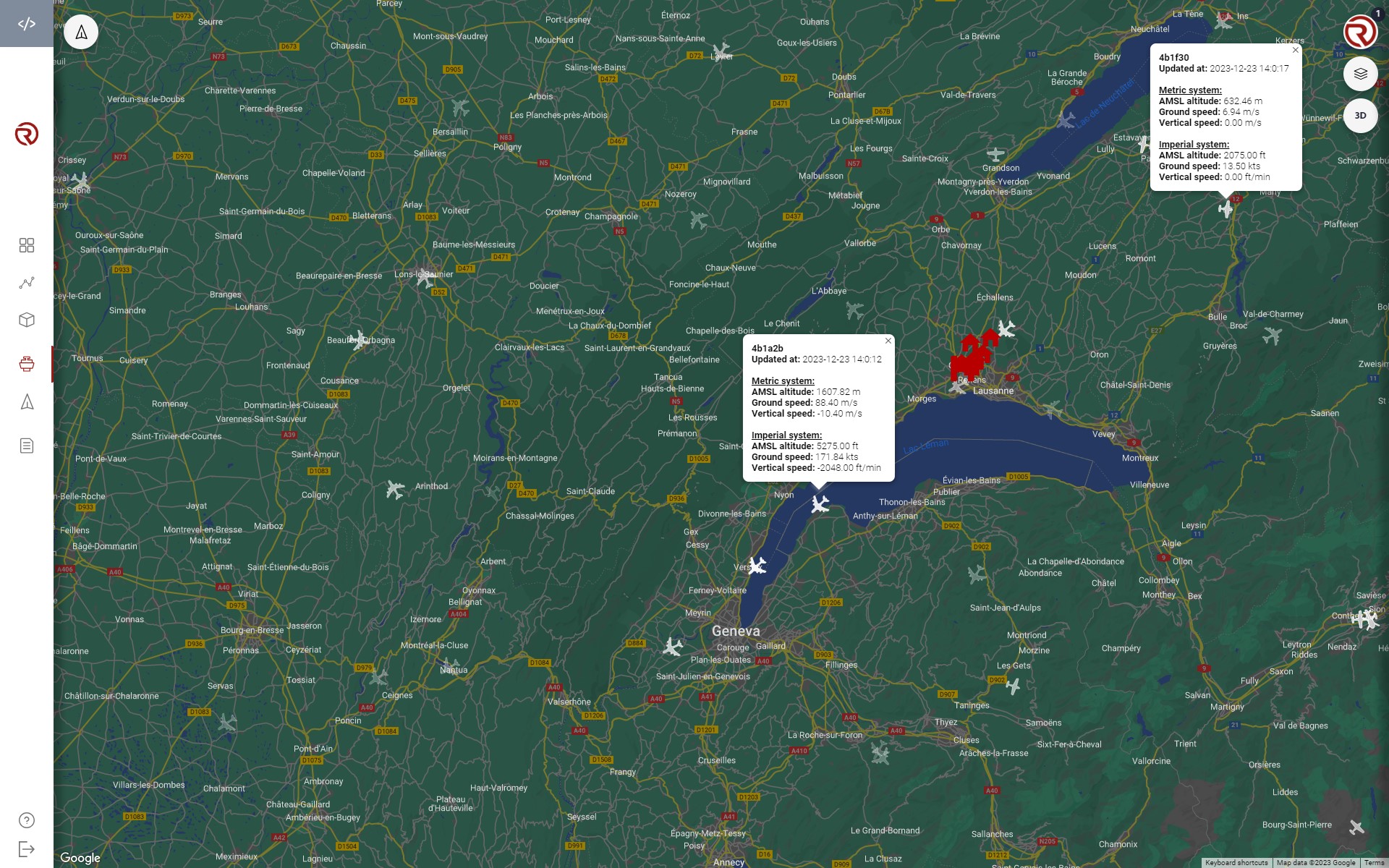
The information described above is shown with different examples in the picture.
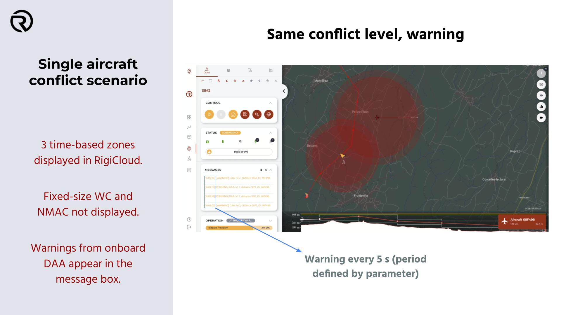
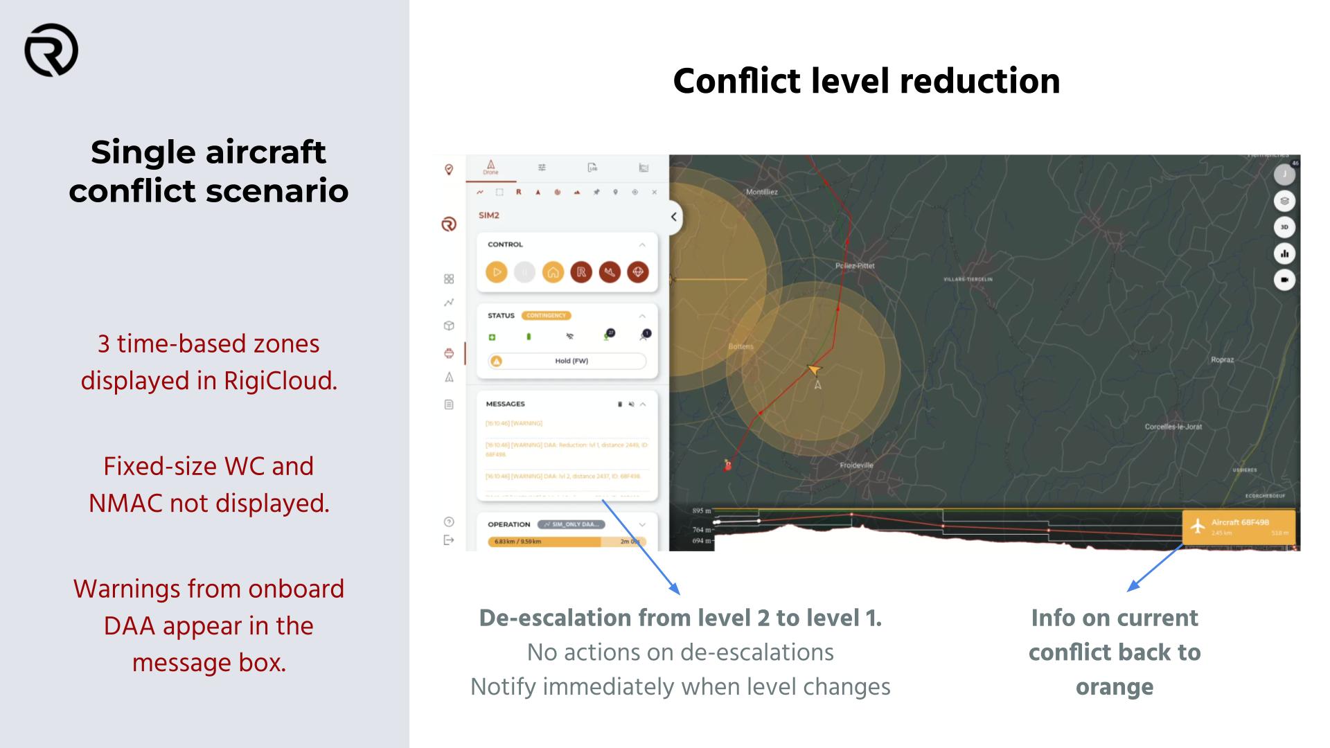
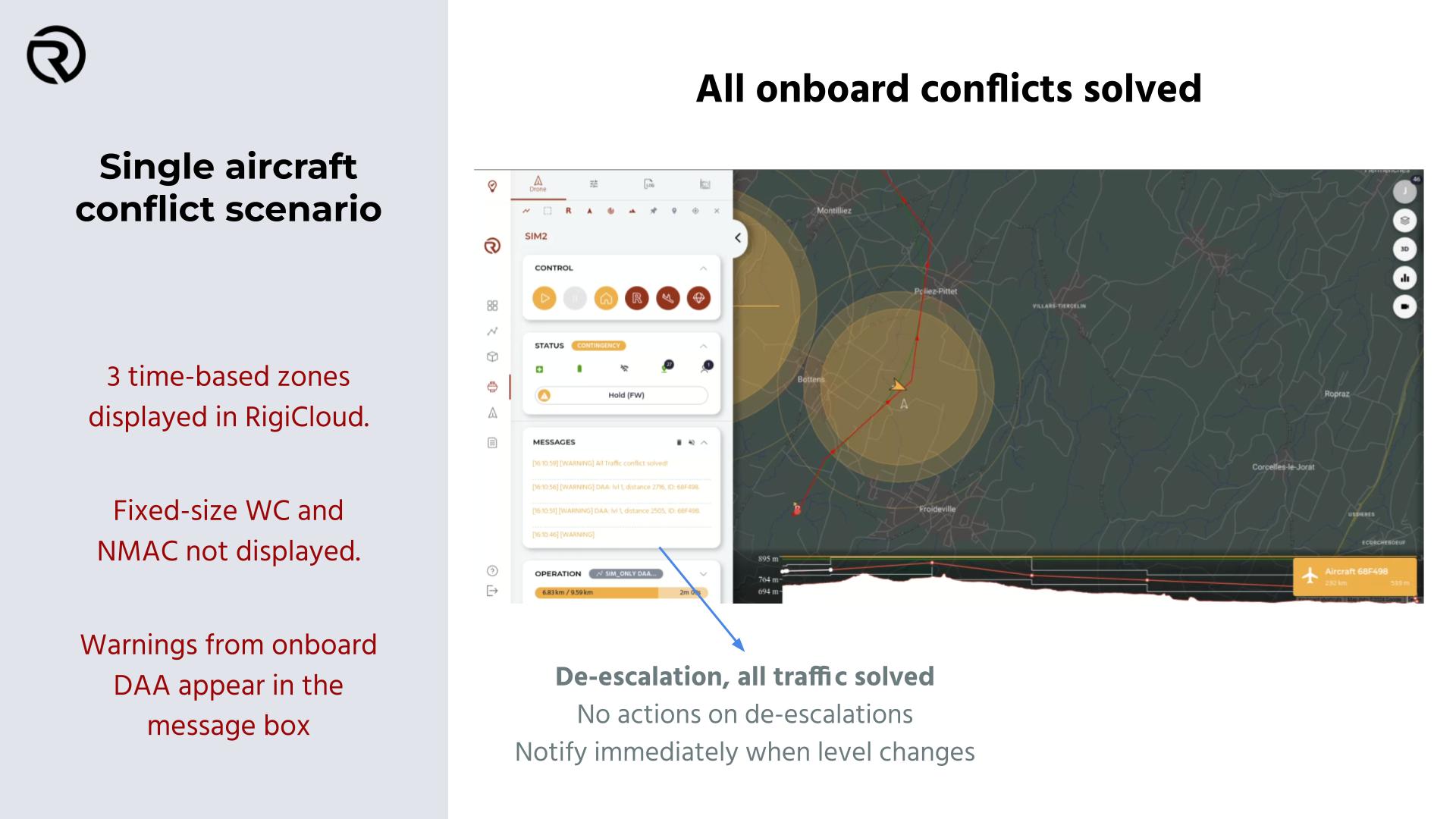
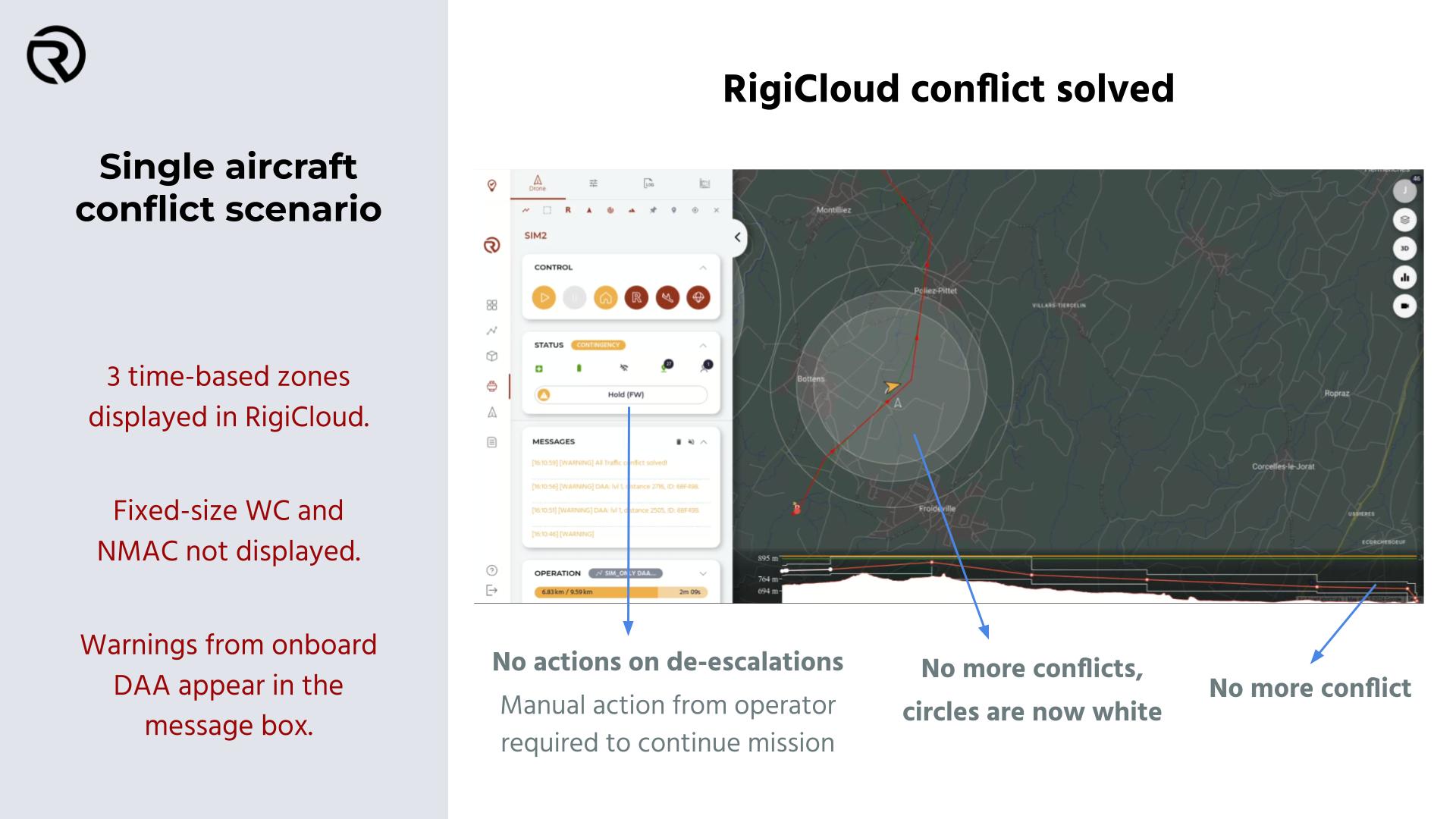
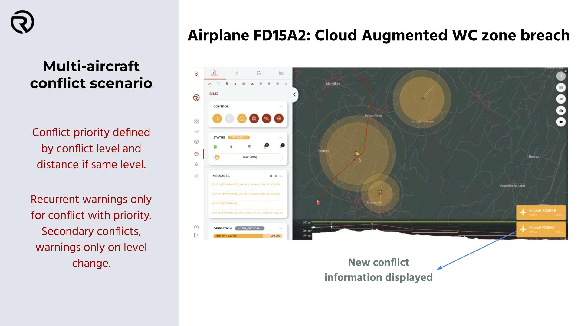
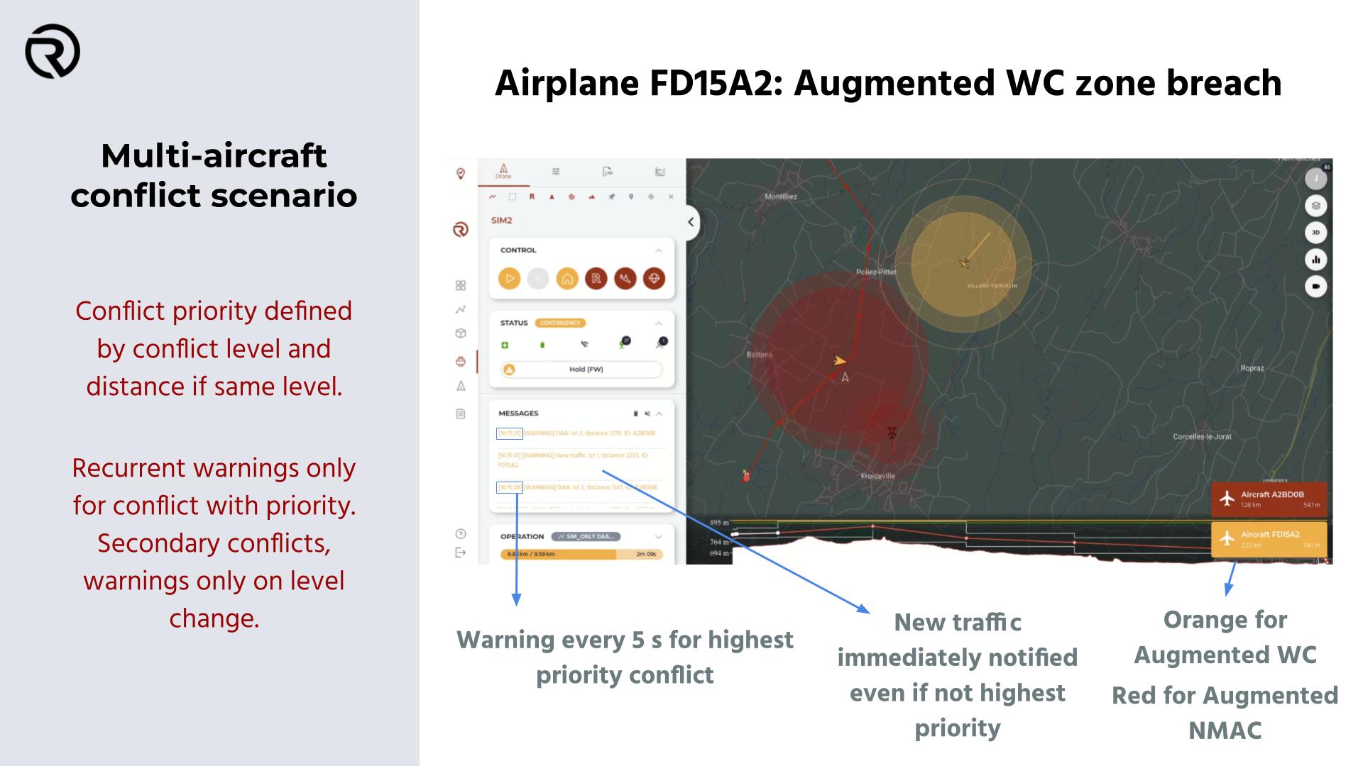
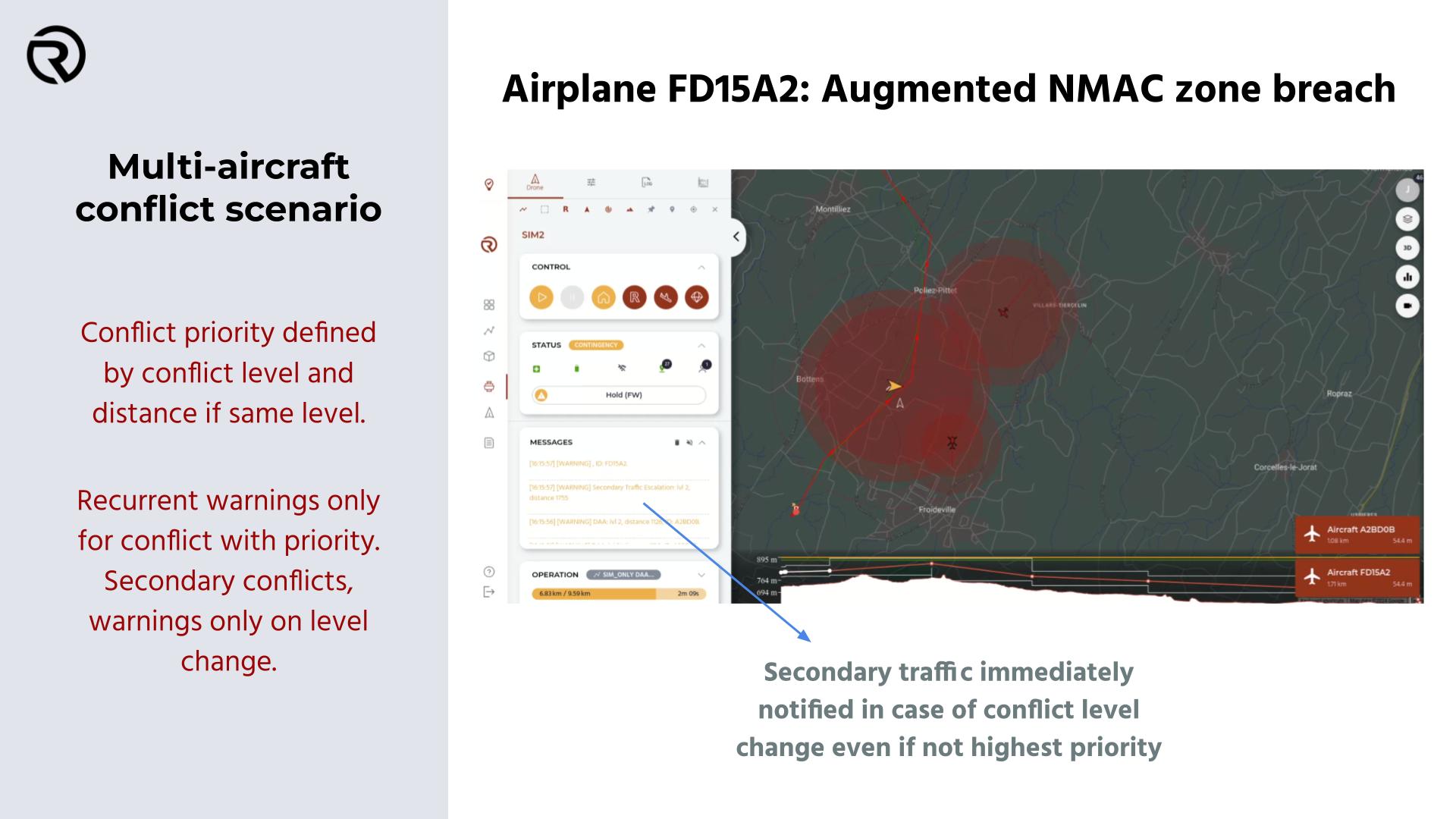
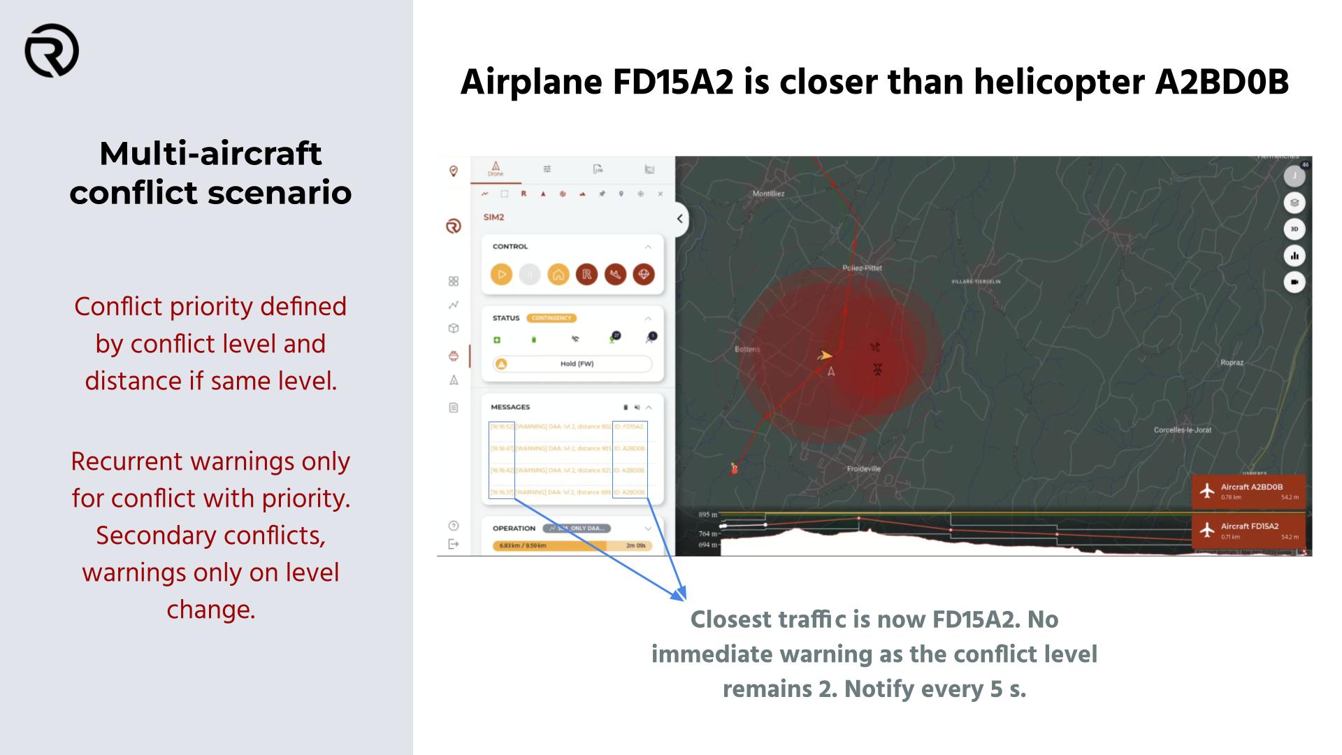
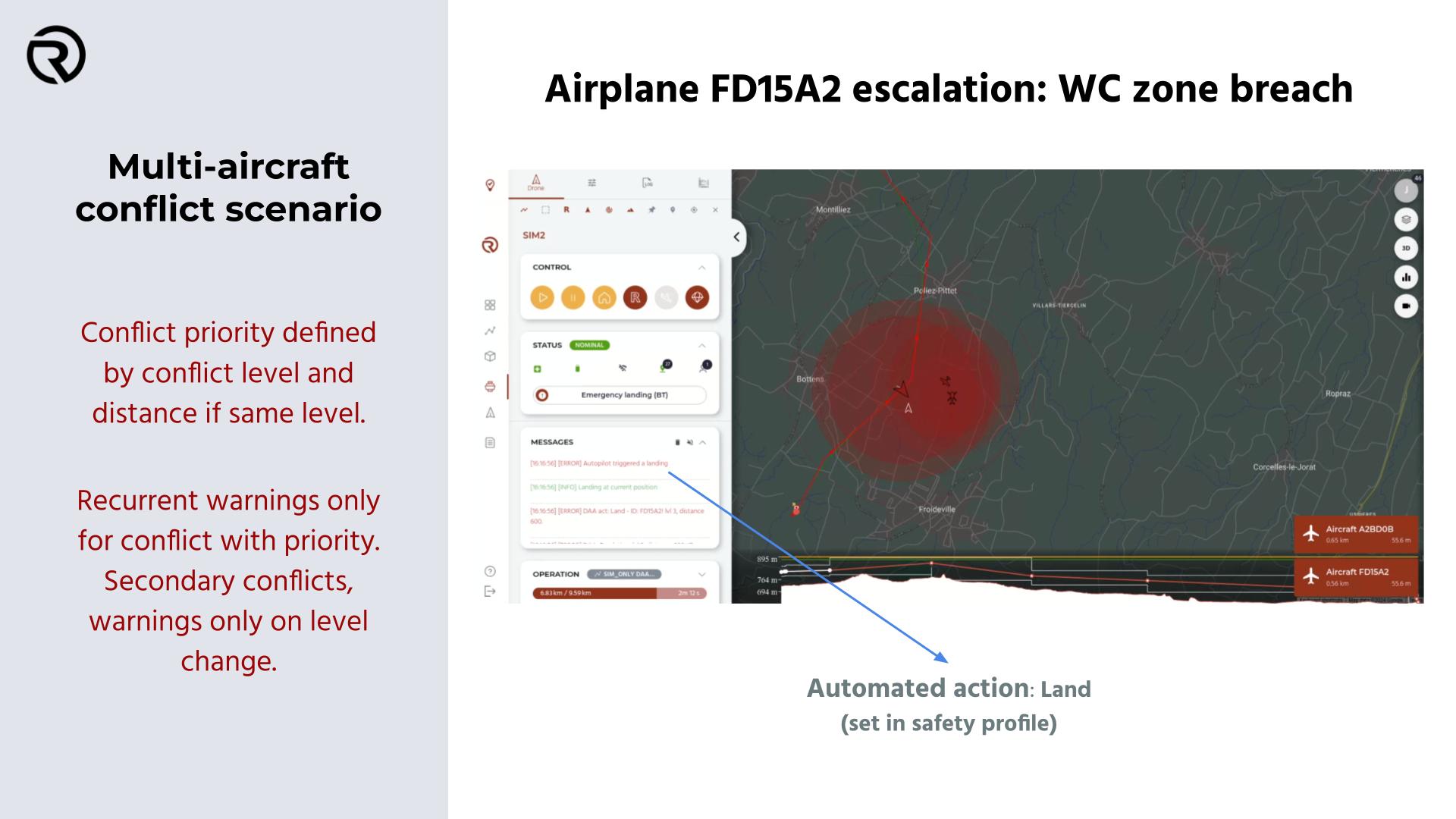
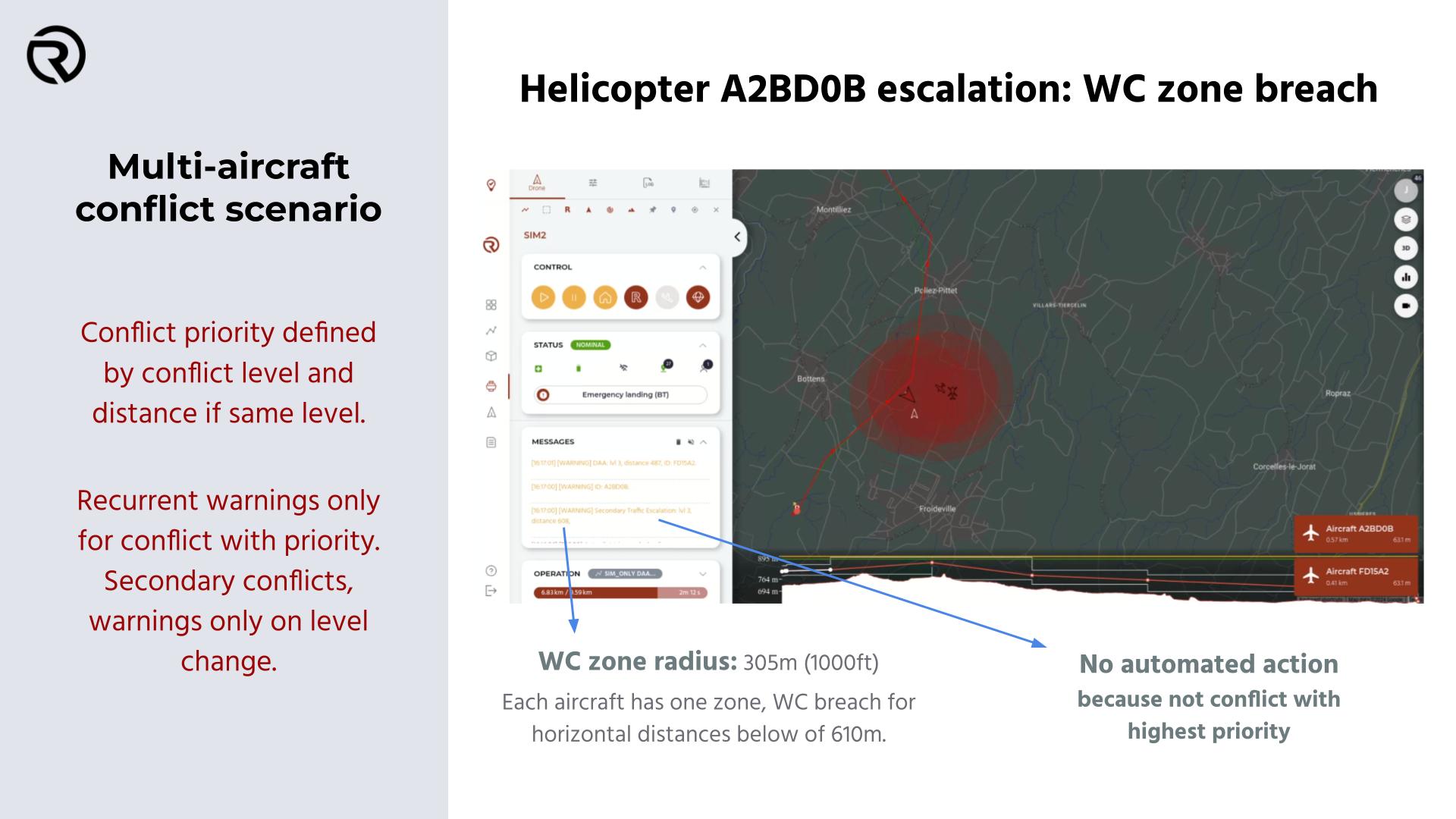
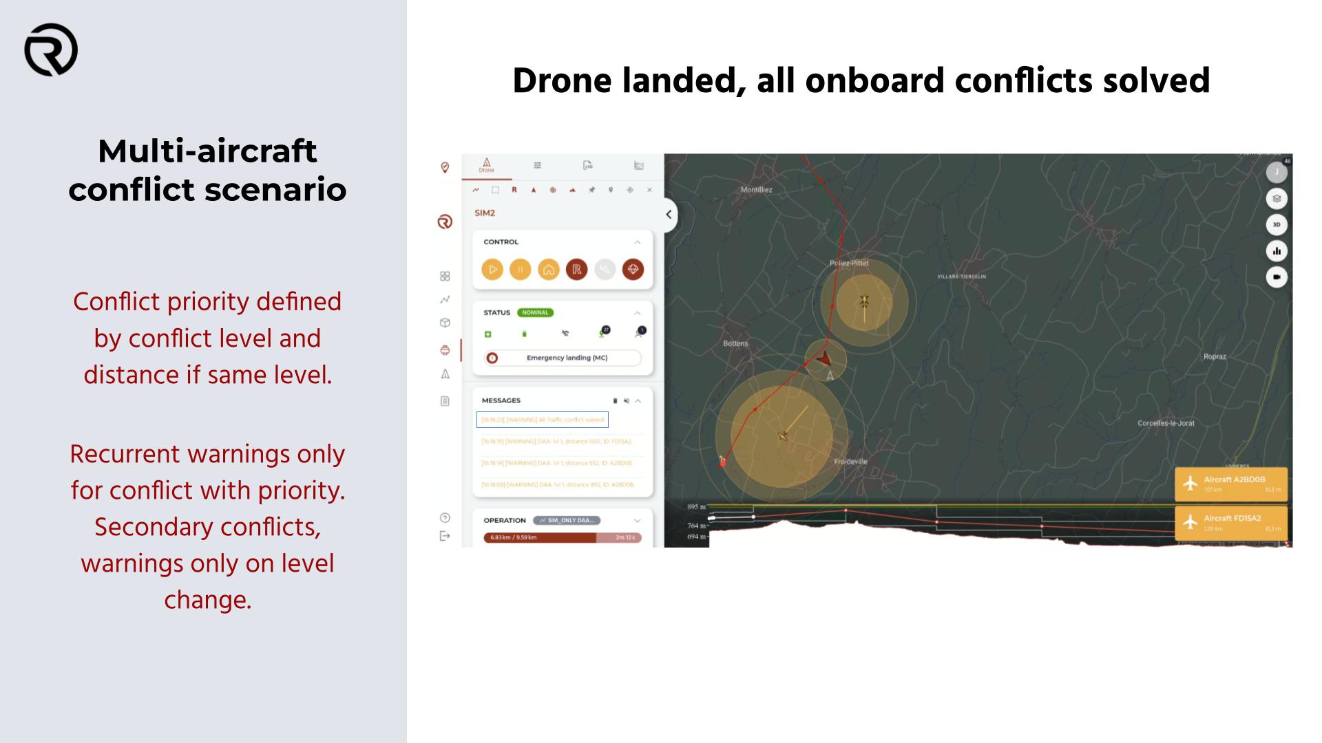
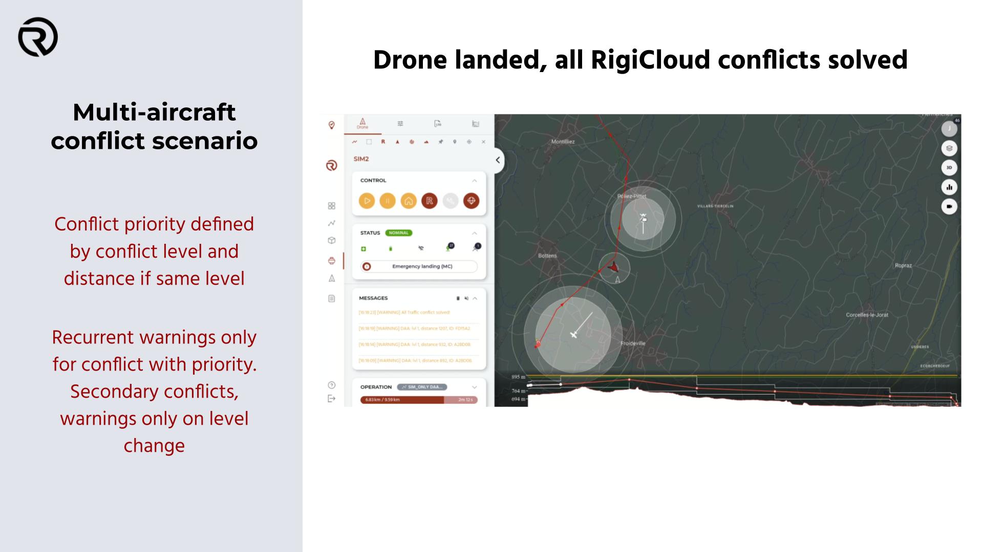
When a UAS/simulator connected, warnings will be displayed when there are close aircraft (within the flight detection area). The warning shows the ID of the aircraft, its distance to the UA and the difference in altitude with it.
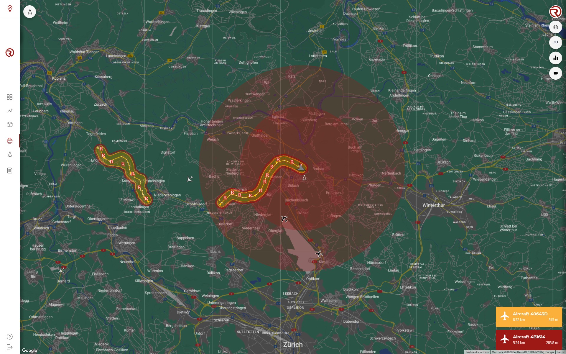
When clicking on an aircraft, its trail will start to be shown, based on the position received in the last 30 s (by default).
Precautions
- If no heading data is received, the aircraft will show a heading to the north (0º).
- If no data of the type of aircraft is received, the default icon is a large airplane.
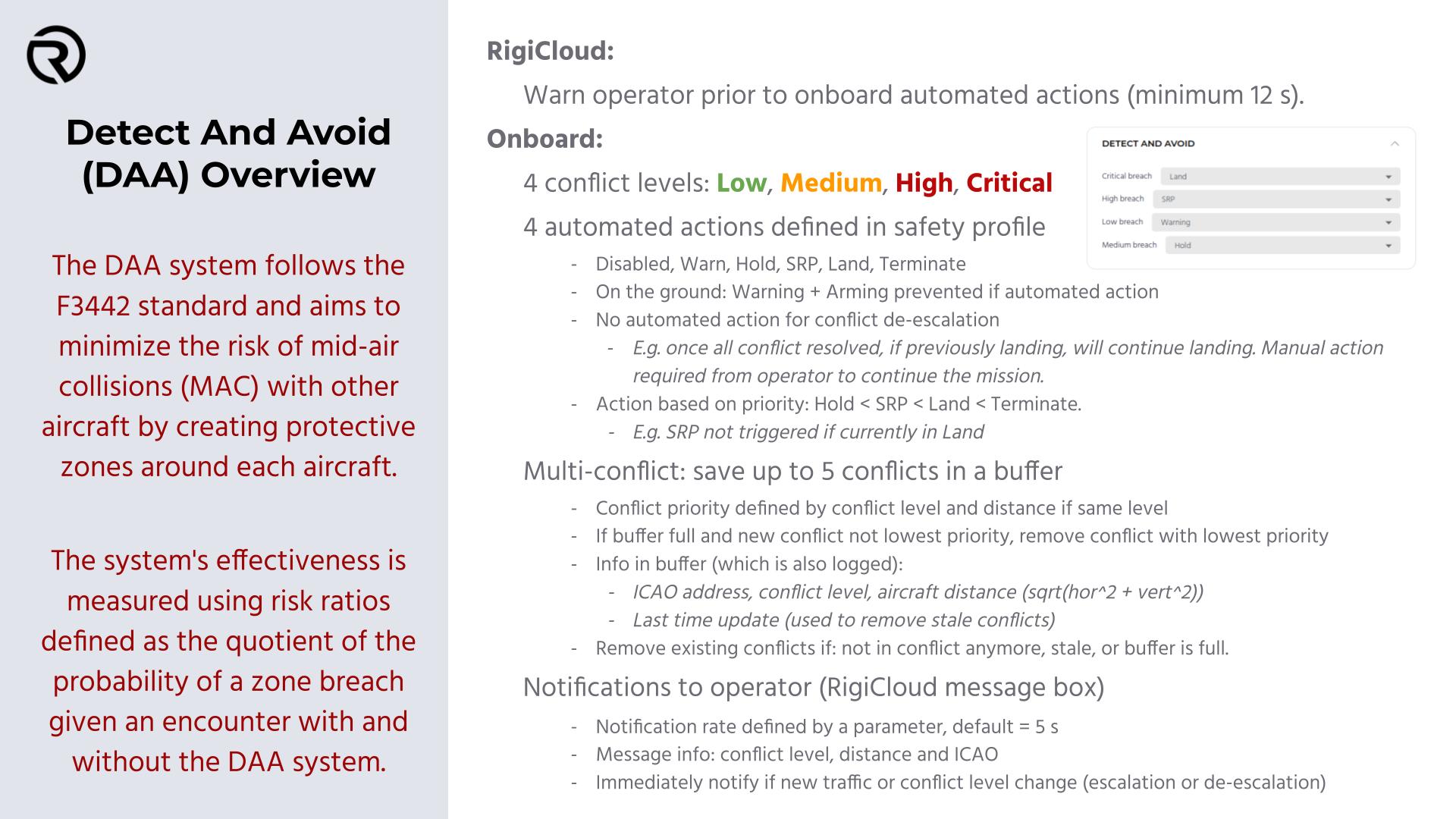
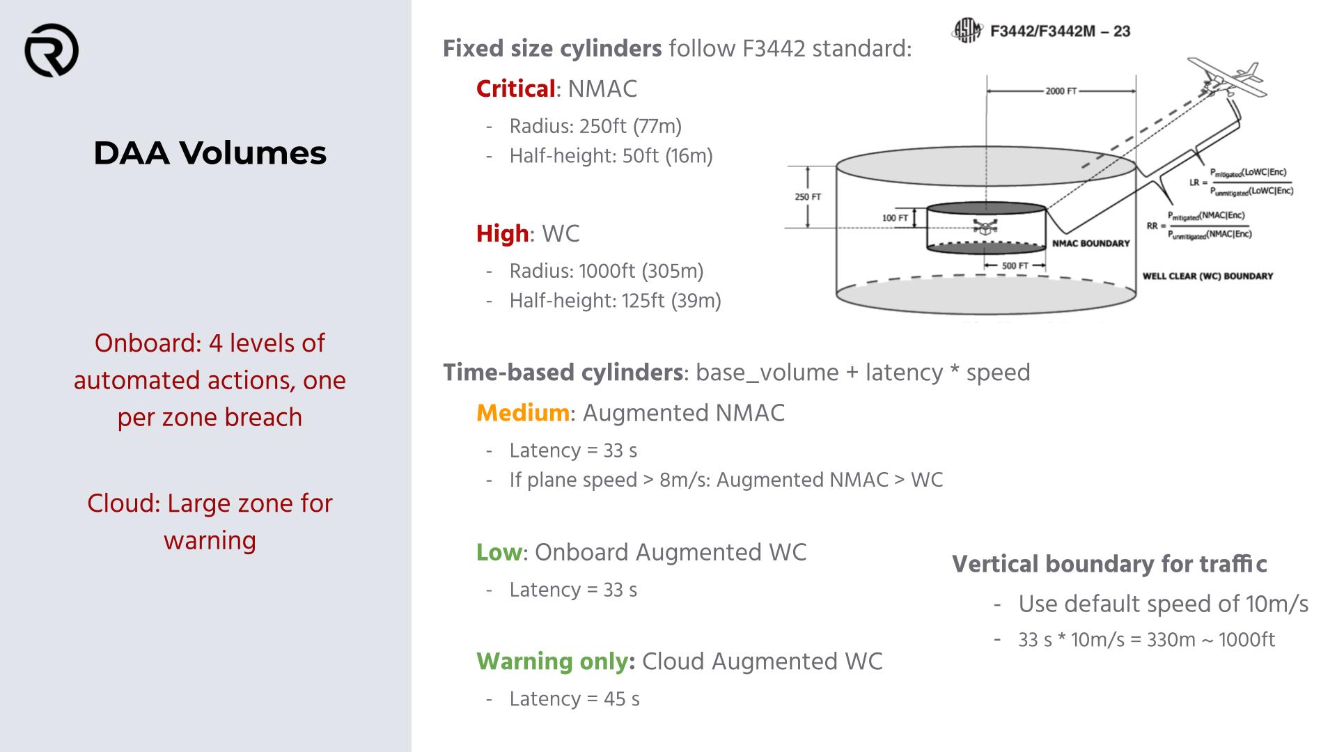
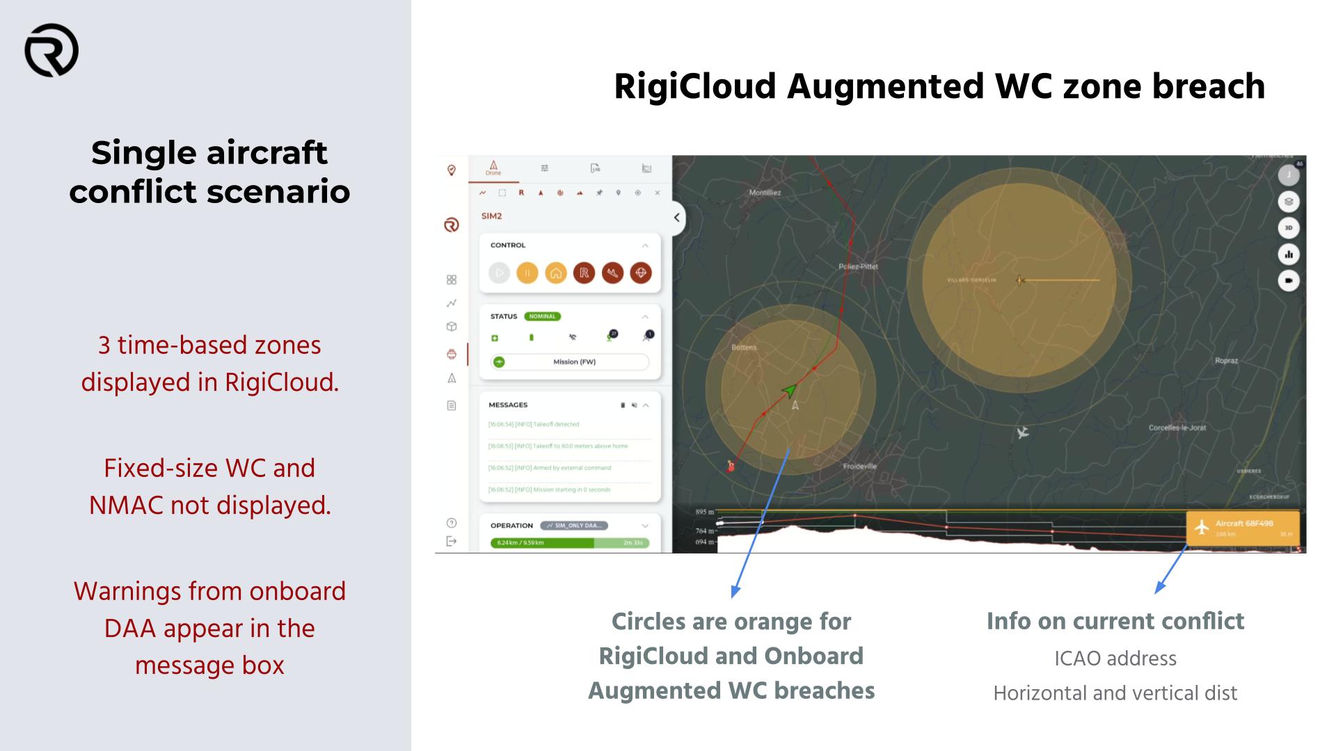
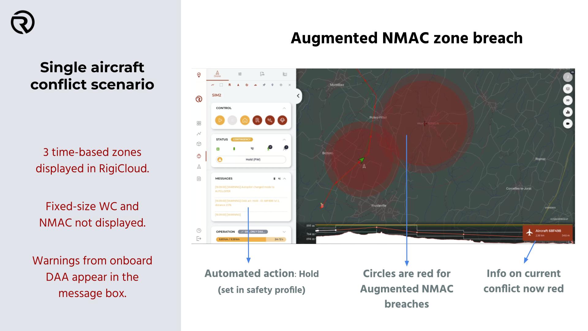
Detect and Avoid
This section shall be complemented with the UAS Flight and Technical Manuals. In particular, extreme precautions shall be taken when defining automated evasion manoeuvres based on the detection of other aircraft in the different conflict levels:
- NMAC: Near Mid Air Collision
- WC: Well Clear
- Augmented NMAC
- Augmented WC
- RigiCloud Warning